
CASE STUDY : Map Shelly Bay
DATE : 2023 - present
NOTES : Culture & Heritage - Digital Map of Motu Kairangi
LINK : https://www.toi.agency/studies/motu-kairangi

TOIAGENCY project *powered by iSPARX™
map Shelly Bay
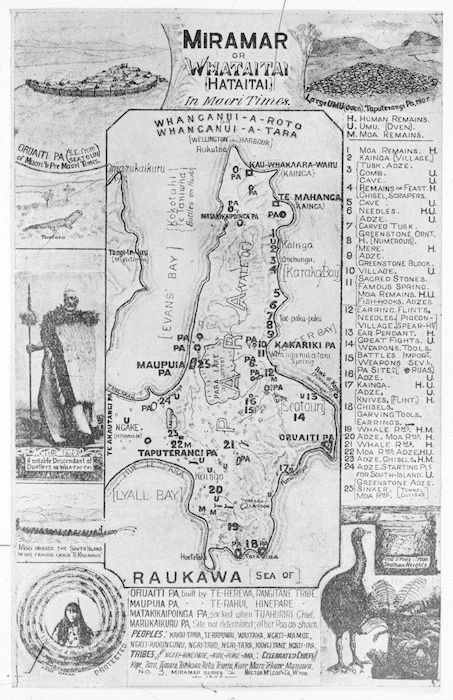
In the 1820s and 1830s, a collection of peoples from multiple Māori iwi (tribes), including Te Āti Awa, Taranaki, Ngāti Ruanui, and Ngāti Tama, migrated to the region. This group became known as Taranaki Whānui ki te Upoko o te Ika.
The village sited at the northern end of the bay was named Maru-Kai-Kuru. The peninsula was known as…
Motu
Kairangi
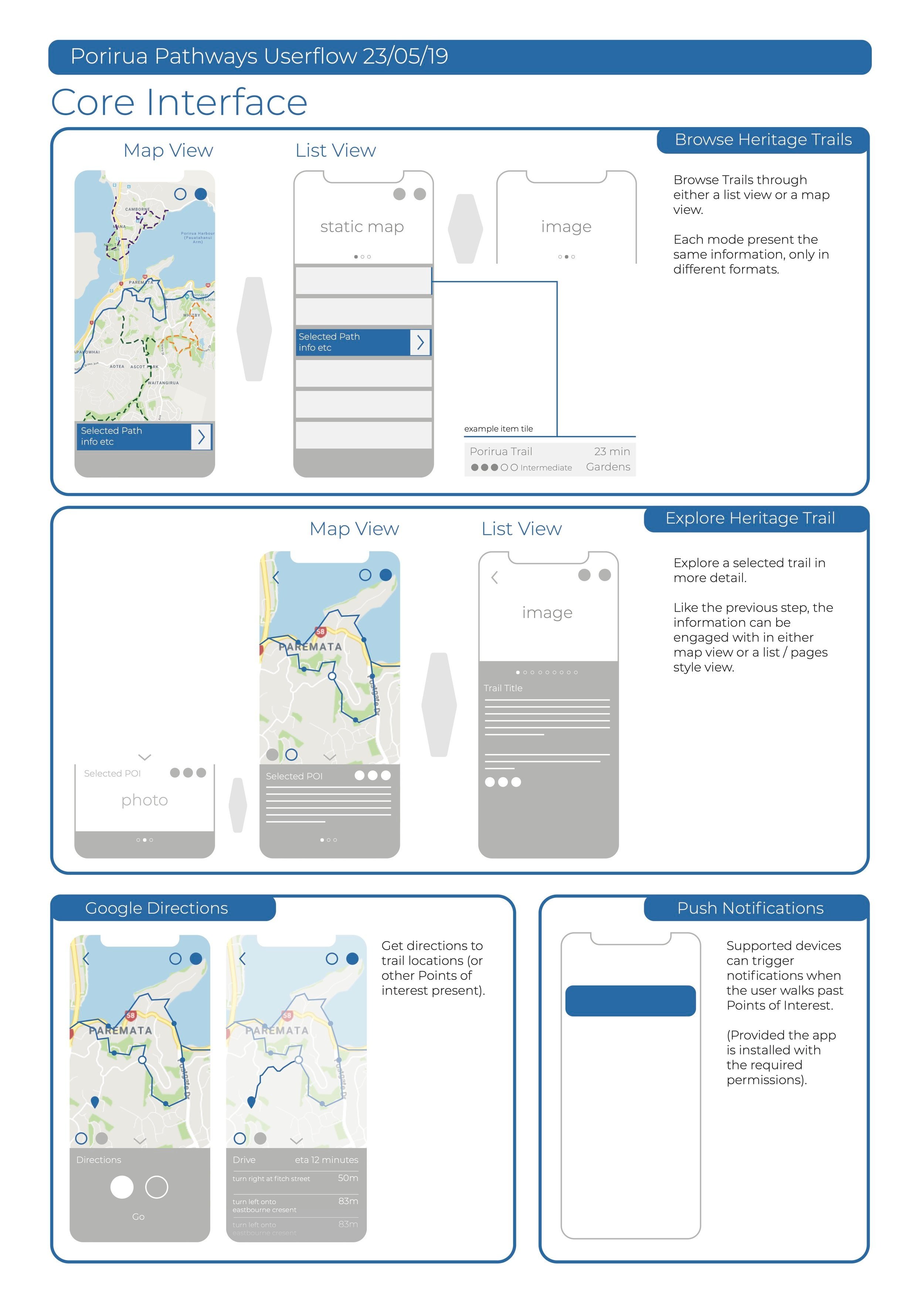
a digital map
Creating a geospatial map of Motu Kairangi and the Shelly Bay area offers substantial benefits to both Mana Whenua and Tangata Tiriti.
For Mana Whenua, this map provides a powerful tool for preserving cultural heritage, enhancing resource management, and strengthening their connection to the land. It enables the accurate representation of significant sites, ancestral pathways, and ecological resources, facilitating informed decision-making and cultural revitalization efforts. Additionally, the map fosters collaboration with local authorities, empowering Mana Whenua.
In terms of Te Tiriti Partnership, this map promotes transparency, equity, and mutual understanding between Mana Whenua and governmental bodies. It establishes a foundation for respectful engagement, ensuring that policies and projects consider the cultural, social, and environmental interests of all parties involved. This geospatial representation thus serves as a vital tool in upholding the principles of the Te Tiriti o Waitangi, ultimately leading to a more harmonious and inclusive approach to community development.


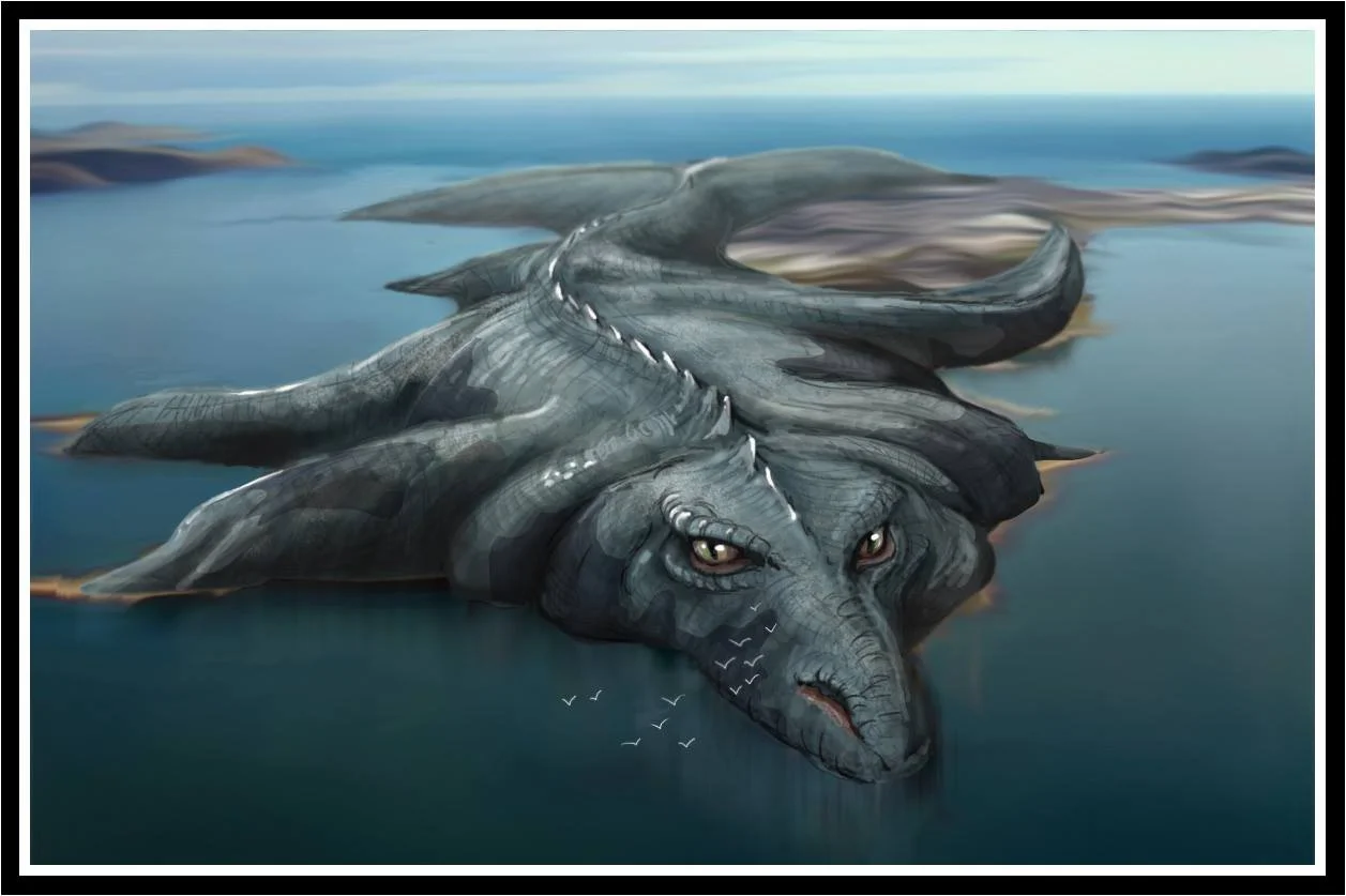
*cover illustration - Whataitai - the legend of Ngāke and Whataitai, Taniwha of Te Whanganui a Tara; image used with kind permission of the artist Mathias Larserud ©2024 M.Larserud - all rights reserved